A collaborative initiative between the Transylvania Citizens Improvement Organization & Morning Glory Inspirations
Transylvania County, Western North Carolina
“Don’t live a lifetime without knowing the rich legacy of your own community.”
“Faces Of Freedom” photograph by N. Karesh
About the Project
The African American Storyline Project was born from a simple and urgent recognition: black history was not represented in Transylvania County. It wasn’t taught in schools. It was barely visible in public spaces. And yet the history was there — in the memories of elders, in the names of streets and neighborhoods, in the stories of churches, stores, schools and gathering places that had shaped generations of lives.
What began as a community-driven effort to put this history on the map grew into one of the most significant cultural documentation projects in the region — bringing together residents, elders, youth, artists, educators and local organisations to capture, preserve and share a story that deserved to be told.
The project was led by Morning Glory Inspirations in collaboration with the Transylvania Citizens Improvement Organization — the same organisation that fought, decades earlier, to integrate Transylvania County’s public schools. Their names appear together on every historical marker installed through this project. That is intentional. That is history honoring itself.
What Was Built
Over the course of the project, with support from grant funding including the Dogwood Health Trust, the following was accomplished:
Installation of approximately 36 permanent historical markers documenting African American history and heritage across Transylvania County — each one a lasting tribute to places, people and stories that might otherwise have been lost
- Installation of approximately 36 permanent historical markers documenting African American history and heritage across Transylvania County — each one a lasting tribute to places, people and stories that might otherwise have been lost
- Development of a self-guided audio walking tour — Downtown Brevard: A Tour of Rosenwald’s Black History — narrated by community voices and available through VoiceMap
- Guided walking tours led through the Rosenwald neighborhood, bringing together community members, elders and visitors in direct conversation with living history
- Oral history interviews, archival research, audio and video recordings preserving the stories and remembrances of community elders
- A weekly Rosenwald News column in the Transylvania Times sharing community history with a broader public audience
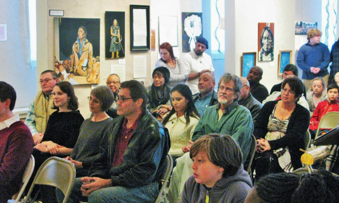
- Community events including Faces of Freedom and the historic Freedom Walk celebrating 50 years of integration of Transylvania County Schools
- Educational and cultural materials developed for community sharing and awareness
- An HBCU tour of North Carolina bringing students and adult guides — the majority people of colour — to visit historically Black colleges and universities
What It Felt Like in Practice
Numbers tell part of the story. What they cannot capture is what it felt like to stand on those streets with people who had never known this history — and watch something shift.
Young and old attended the guided tours. Mostly white audiences leaned in, asked questions and wanted to know how they could get involved. Neighbors came outside as groups passed and offered impromptu stories and remembrances that no research could have uncovered. On one occasion, a young boy arrived reluctant and standoffish — and by the end of the walk, was reading the historical markers aloud to the group himself.
A community elder’s marker about a beloved neighborhood store prompted a well-known opera singer who grew up in Brevard to share memories of grape tootsie rolls, orange sodas saved especially for him and Saturday mornings spent on the hill between houses. Those are the moments this project was made for.
What became clear through this work was something simple and profound: the in-person connection could not and should not be replaced. People were looking for a way to connect with the Black community. This project offered that — and in doing so, became something larger than any single marker or tour could contain.
The Living Archive
The African American Storyline Project generated a significant body of material — audio recordings, video documentation, interviews, photographs, articles and archival research — that represents an irreplaceable record of African American life and history in Transylvania County.
This work was made possible with generous support from the Z. Smith Reynolds Foundation (initial funder) and the Dogwood Health Trust, and with the encouragement of community partners including Conserving Carolina, whose Executive Director wrote in support of the project: “protecting land also means protecting the stories that are carried with the land.”
One vision that remained unrealized — when COVID arrived and life shifted — was an outdoor interactive kiosk along the Rosenwald greenway: a kind of open-air mini museum where locals and visitors could engage with the history, listen to audio and video recordings, and connect with the living archive on location. That dream is not forgotten. It is simply waiting for the right moment and the right partners.
This archive is a resource waiting to be more fully shared. If you are a researcher, educator, heritage organisation, filmmaker or community partner with an interest in this material or in continuing this work, we would love to hear from you.
📧 nicolakaresh@gmail.com
Historical Markers — Transylvania County
The following markers were installed as part of Phase 1 and Phase 2 of the African American Storyline Project. Each marker features imagery and a short narrative relating to local Black history and is installed in a visible, accessible location.
#1 Goose Hollow — located off of Rosenwald Lane
#2 “Old” Rosenwald School — located off of Rosenwald Lane
#3 Rosenwald School — located off of Rosenwald Lane
#6 Happy Hollow — located off of Thomas and W. Main Street
#8 Bethel Baptist Church — located off of Mills Avenue
#9 Mr. Jip’s Store — located off of Mills Avenue
#10 Georgia Hill — located at the bottom of Mills Avenue across from the Mary C. Jenkins Community Center
#11 Mary C. Jenkins Community Center — located at the intersection of Carver Street and Mills Avenue #12 Greasy Corner — located at the junction of Carver and Oakdale Streets, Mills Avenue and Cashiers Valley Road
#13 Silversteen Memorial Playground — located at the junction of Cashiers Valley Road and the base of Mills Avenue
#14 Mickey Park — located off of Silversteen Road
#15 The “Tannery” — located off of Cashiers Valley Road
#16 Ms. Mat’s and Ms. Dot’s Store — located across from the Mary C. Jenkins Community Center
#17 Mr. Will Gardin’s and Mr. George Bailey’s Taxi Stand — located at the base of Carver Street
#18 Daddy Roy’s (Hutchison) Store, Café & Dance Hall — located across from the Mary C. Jenkins Community Center
#19 Blue Diamond and Deep Cover — located across from the Mary C. Jenkins Community Center
#20 Mr. Ed Killian’s Taxi Stand
#21 Mrs. Annie Bell Killian’s Store — located off of Carver Street
#22 Bethel “A” Baptist Church — located off of Oakdale Street
#23 Fire Baptized Holiness Church — located on Oakdale Street
#24 Mr. Grady Elliott’s & Mack Butler’s Café — located across from Bethel “A” Baptist Church
#25 Mill’s Chapel A.M.E. Church — located off of Carver Street
#26 Mountain Lily Lodge / Betsill Barber Shop — located off of Carver Street
#27 Henry’s Barber Shop / Green Onion — located off of Carver Street
#28 Eliza’s Rooming House — located off of Carver Street
#29 Condrey Sharp Boarding House — located off of Carver Street
#30 Jim Aiken’s / Moms Mabley’s Home Place — located off of Oaklawn Street
#32 Clemson Theater — located off of S. Caldwell Street
#34 Frogg Bottom — located near intersection of E. Appletree and N. Johnson Streets
#36 Glade Creek Cemetery — located off of Kemp Road in Pisgah Forest
#37 Glade Creek Baptist Church — located off of Kemp Road in Pisgah Forest
#38 Glade Creek School — located off of Kemp Road in Pisgah Forest
#39 French Broad Baptist Church — located off of Everett Road in Pisgah Forest
#40 French Broad School — located off of Everett Road in Pisgah Forest
#41 French Broad Cemetery — located off of Everett Road in Pisgah Forest
#42 Everett Farm School — located off of Everett Road in Pisgah Forest
#43 Cooper Cemetery — located off of Deerwoode Lane
#44 Pinnacle — located above Brevard Music Center, off of Pinnacle Road
“Captivating, historical & cultural tours, talks and experiences. When you’re ready for that unforgettable experience, we’re ready to take you there.”
— Morning Glory Inspirations
